LOOP AND LINE OY
Geophysical measurements and consulting
|
Services
We make geophysical measurements to map geological structures below the ground surface. We also consult and interpret the results. Typical targets are electric conductive mineralization (exploration) and fracture zones (rock engineering). Method
We use electromagnetic FrEM system. This multi-frequency sounding system applies many different measuring frequencies from 10 kHz to 100 Hz. The highest frequency gives information from near surface area (overburden and the uppermost rock layers). Each lower frequency gives information from deeper level. Penetration depth of each frequency is depending on local conditions. |
Map
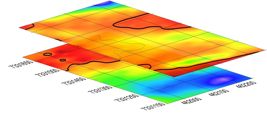
The anomaly map shows variation of electromagnetic field measured by one frequency. Variation in the anomaly map indicates variation in geology. The 3D map is a combination of many maps referring to different depths. |
|
Interpretation
Measured data fulfill scientific requirements. Professional modelling tools are used to simulate measurements and to find possible theoretical models that give similar results than measurements on the field. |
Data
Receiver unit measures 3 orthogonal components (vectors XYZ) of electromagnetic field. All directions have two phase components - primary and secondary field. The FrEM system measures also current of transmitter loop (controlled source field), GPS position, azimuth of receiver unit (3-component magnetometer) as well as tilt and rotation angles of receiver unit (3-component accelerometer). The new system, FrEM
The FrEM method is a new and not so much used system. It has been under very active developing process during last years. It has proved its effectiveness in many cases. However, electromagnetic data is sometimes difficult to interpret. Especially below some conductive structures. Last remarkable steps in this development process have been the completing of two inversion applications for theoretical modelling calculations in summer 2017 as well as the preparation of two borehole devices ready for borehole measurements. Devices are owned by Geological Survey of Finland and they are wireless autonomous systems. |
|
Cases
In Vehkalampi (Central Finland) area we measured 50 stations with 41 frequencies. In theoretical simulation, we found out that the best model was a thin semi-vertical conductive plate (graphite) inside the conductive host. This model was unexpected, but afterwards it was proved that the model was making perfect match with core samples! |
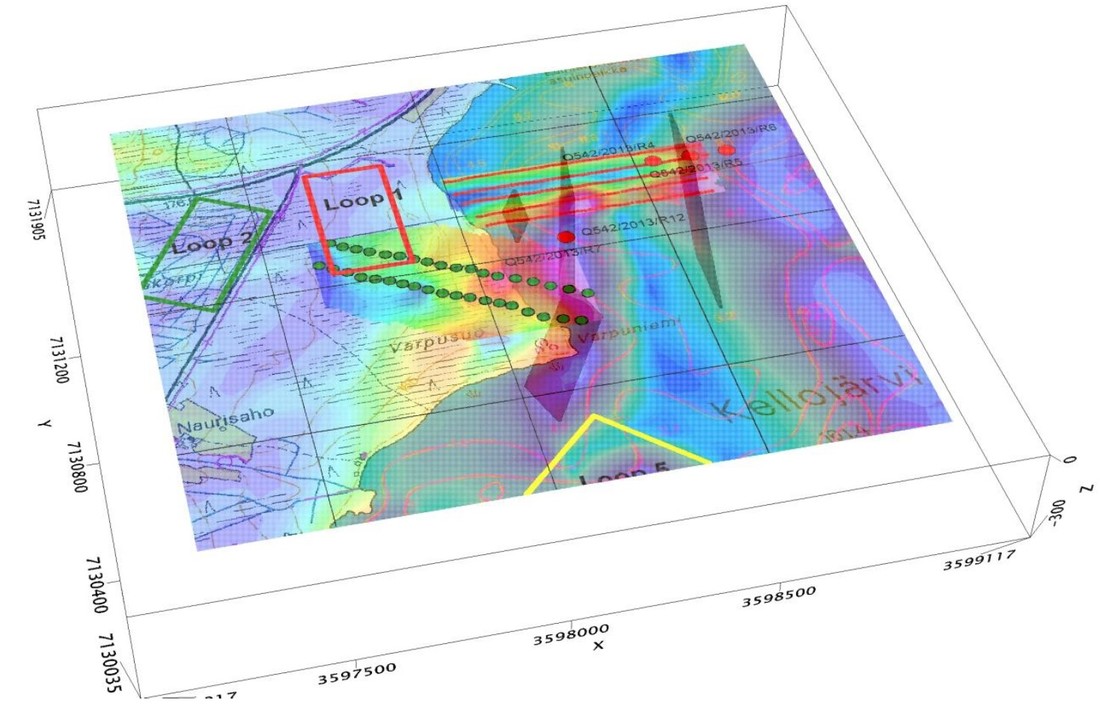
In Kellojärvi (Kuhmo greenstone belt, Eastern Finland) site we measured a long line over two different geological units. The first anomaly detected in a primary field was caused by a magnetic susceptibility high. The second anomaly in secondary field was caused by a conductive body. Later we found a long tail of this conductive body going deeper in to the bedrock. On the frozen Kellojärvi lake we also tested successfully the fast-moving system. We measured 12 km line length in 2 hours with a snowmobile. This measurement produced also accurate 3-component magnetic data
In Niittylampi (Suhanko intrusion, Northern Finland) area we measured 175 stations with five simultaneous frequencies. From differences in the five anomaly maps, it was easy to estimate the continuation direction of a weakly conductive body from surface to depths. At this exploration site, we also detected and interpreted the horizontal conductive layer at the depth of 600 m. The conductive layer was already known and ensured by the core drilling years ago.
|
|
Contact Information
Loop and Line Oy Mr. Jarkko Jokinen CEO, geophysicist, Ph.D. +358 40 840 1060 jarkko (at) loopandline.fi |
Leaflet
| ||


